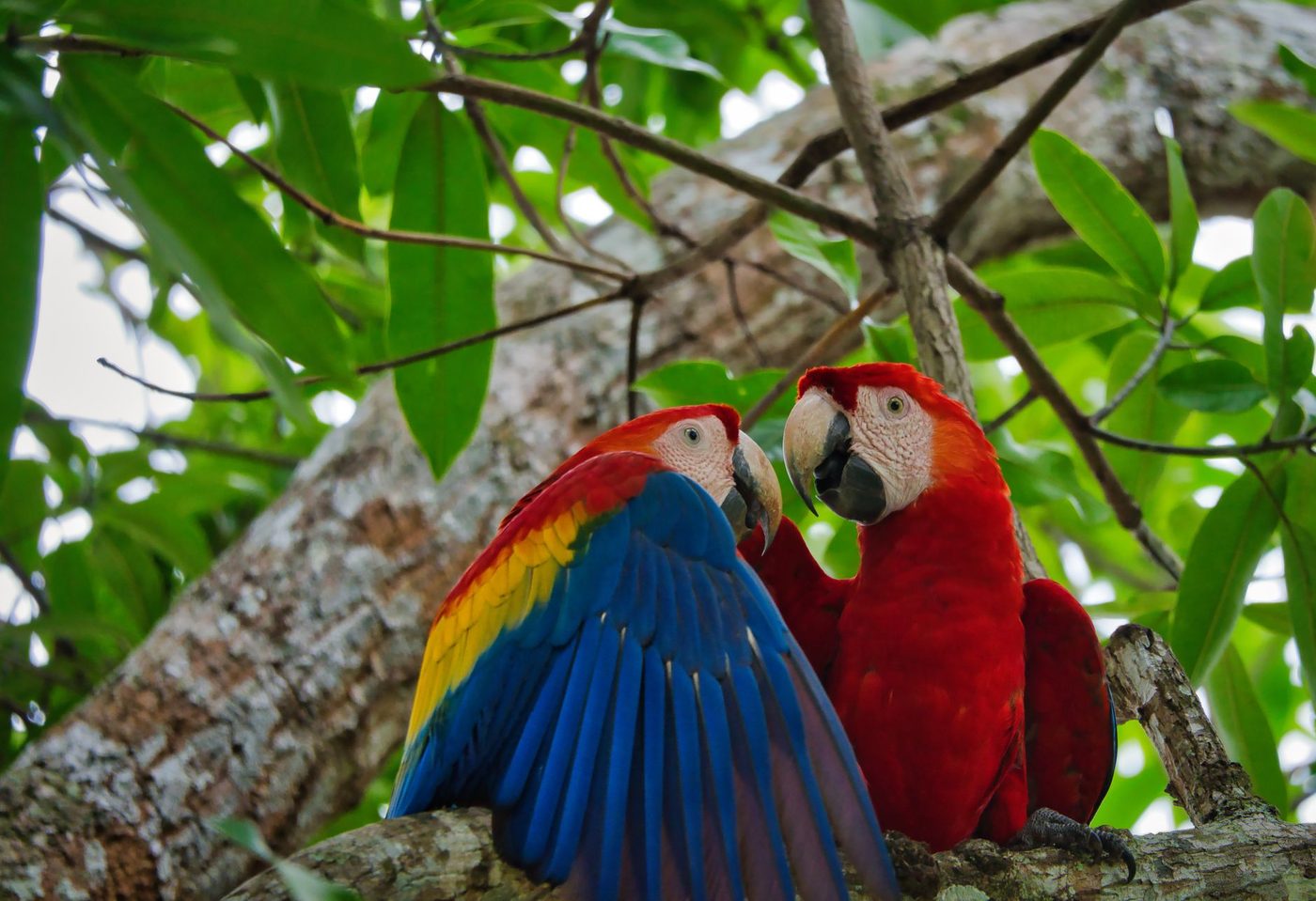
9 Old Photos of Guanacaste That Show How Far the Gold Coast Has Come
Nine openly licensed photographs trace Guanacaste's road from cattle country to Costa Rica's busiest tourism coast.
Genuinely old Guanacaste photos are hard to find online, but the freely licensed images that do exist tell one clear story. In a few decades this province went from cattle haciendas and quiet fishing beaches to Costa Rica's busiest tourism coast. Here are nine verified, openly licensed photographs that show how far the Gold Coast has come.
Where do old photos of Guanacaste actually live?
We want to be honest about the limits of a post like this. Most historic images of the province sit in Costa Rica's National Archive and in family albums, and those are not free to republish. So we built this collection of old Guanacaste photos only from images on Wikimedia Commons with licenses we verified ourselves (public domain or Creative Commons), spanning 1980 to 2013, plus two buildings so old they are windows into the 1600s. Full credits are listed at the end. And a request: if your family has old photos of Playas del Coco, Ocotal, or Sardinal and you are open to sharing scans, we would genuinely love to see them.
1. The colonial church of San Blas in Nicoya
Start with the oldest thing you can still photograph in Guanacaste. The white church of San Blas in Nicoya was first built in 1644 and rebuilt in 1831, and it anchors one of the oldest towns in Costa Rica. Arnaldo Rodriguez Espinoza's 2010 photo shows it before the restoration that reopened it in July 2019. Nicoya also matters to this story for another reason: on July 25, 1824, the people of the Partido de Nicoya voted to join Costa Rica, the event behind the Guanacaste Day celebrations we wrote about in our Guanacaste Day post.
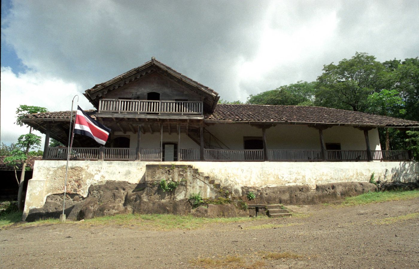
2. La Casona de Santa Rosa, photographed in 1999
Our cover photo is a real historical document. Biologist Julian Monge-Najera photographed the wooden casona of Hacienda Santa Rosa in July 1999. Two years later, in May 2001, a fire destroyed most of the building; La Nacion reported that roughly 80 percent of Costa Rica's most important historical monument was lost in a single night. This is the house where, on March 20, 1856, Costa Rican forces expelled William Walker's filibusters in a battle that lasted about 14 minutes. The casona has since been rebuilt, but photos like this one preserve the original.
3. The full hacienda compound, before reconstruction
The same 1999 series includes a sweeping panorama of the Santa Rosa compound, stitched to more than 12,000 pixels wide. The photographer's own note on Wikimedia Commons says it plainly: only these photographs remain of how the house was. Santa Rosa was a working cattle hacienda for some three centuries before it became a national park in 1966, and cattle, not tourism, paid Guanacaste's bills for most of its history. The sabanero on horseback is still the symbol of the province for a reason.
4. Palo Verde's dry forest in December 1980
This one is a personal favorite because it is so ordinary. In December 1980, Australian naturalist David Fischer photographed a stretch of tropical dry forest at Palo Verde, in the Tempisque lowlands, to document butterfly habitat. No hotels, no signage, no people. That was most of Guanacaste in 1980: ranch land, wetlands, and forest, a few years before anyone had drawn up serious plans for an international tourism coast. It reminds us how recent everything in the next five photos really is.
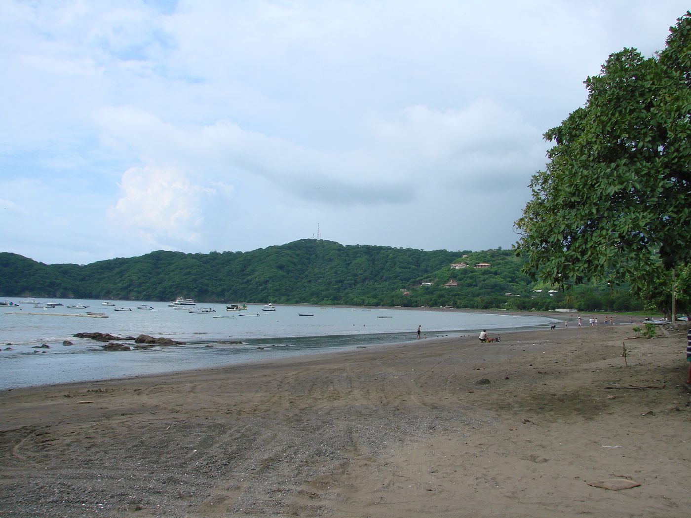
5. Playas del Coco's beachfront in July 2008
Our mid photo, taken by Wikimedia contributor Tizianok in July 2008, shows the beach at Playas del Coco less than twenty years ago. The crescent bay and the headlands are exactly the ones you see today. Almost everything around them has changed: the beachfront has been remodeled, the town has filled in, and the anchorage now shares the bay with tour boats. If you want the longer arc, from fishing village to port town to expat hub, we traced it in our history of Playas del Coco.
6. The Automercado plaza at dusk, 2012
Not every historic photo is dramatic. Paul Henry Orsenigo's April 2012 shot of the Automercado plaza in Coco captures a quieter turning point: the day-to-day economy catching up with the people moving here. A national supermarket chain does not open in a village; it opens where full-time residents live. The photo's own caption still calls Coco "the small beach town," and thirteen years later, locals would smile at that. We covered what still sets the town apart in this comparison of Guanacaste beach towns.
7. The entrance to Pacifico Plaza, 2012
Taken the same month, this photo shows the retail plaza at the entrance to town, part of the master-planned Pacifico community. For anyone who knew Coco as a dusty fishing town, this image marked the new era: gated residential communities, landscaped commercial space, and buyers arriving from North America. It is also a useful honesty check. Coco in 2012 was already a real town with real infrastructure, not a secret. Anyone who tells you they "discovered" it recently is late by decades.
8. A tour catamaran off Peninsula Papagayo, 2013
This March 2013 photo shows the New Marlin, a sailing catamaran that ran tours out of Coco, waiting off the Four Seasons resort on Peninsula Papagayo. The resort opened in January 2004 inside the Gulf of Papagayo tourism development, a state project declared of public interest by law in 1979 and regulated since 1982, covering 1,658 hectares under the management of the Costa Rican Tourism Institute. That project, more than anything else, is why this stretch of coast is called the Gold Coast today.
9. Coco's bay from the sand, September 2013
The newest photo in our list, by Haakon S. Krohn, shows Coco's bay in September 2013. It already looks familiar, and that is the point: the biggest visible changes of the past decade have happened behind the beach, not on it. The engine for all of it sits 35 minutes away in Liberia. The airport there opened in 1975 as a regional strip, was rebuilt to international standards in 1995, and got its modern terminal in January 2012. Every one of those dates shows up in Guanacaste's growth curve.
What do these photos mean if you are thinking of buying here?
Two things. First, the growth is real and long-running, driven by infrastructure you can point to: the annexation that made Guanacaste Costa Rican, a state tourism project from 1982, an international airport, and thirty years of steady arrivals. Second, the change is fast enough that most old Guanacaste photos are not very old at all; a picture from 2012 already reads as history, which is worth remembering when you weigh what the next fifteen years could do for a property here. We are not neutral observers; the Expat Properties | CR team lives in Playas del Coco and works in this market every day. If you want to see what today's version of the Gold Coast looks like, browse our current listings or send us a message, and we will give you straight answers about what has changed and what has not.
Photo credits and licenses
All nine photographs are hosted on Wikimedia Commons and were license-checked on August 13, 2026:
- Colonial church of Nicoya, Arnaldo Rodriguez Espinoza, 2010, CC BY-SA 4.0.
- Hacienda Santa Rosa casona, Julian Monge-Najera, 1999, CC BY-SA 4.0 (our cover photo).
- 1999 casona panorama, Julian Monge-Najera, CC BY-SA 4.0.
- Dry forest at Palo Verde, David Fischer, 1980, CC BY-SA 3.0.
- Playa del Coco, Tizianok, 2008, CC BY-SA 3.0 (our mid photo).
- Automercado at dusk in Playas del Coco, Paul Henry Orsenigo, 2012, CC BY-SA 3.0.
- Entrance to Pacifico Plaza, Paul Henry Orsenigo, 2012, CC BY-SA 3.0.
- New Marlin in Playas del Coco, Elcocobeach, 2013, CC BY-SA 3.0.
- Playa del Coco Guanacaste, Haakon S. Krohn, 2013, CC BY-SA 3.0.
Frequently asked questions
Where can I find old photos of Guanacaste, Costa Rica?
The largest collection sits in the National Archive of Costa Rica in San Jose, which holds historic photographs and documents from across the country. Online, Wikimedia Commons hosts a smaller set of freely licensed images, and community Facebook groups in Coco, Sardinal, and Liberia regularly share scanned family photos. Always check the license before republishing any image.
When did Guanacaste become part of Costa Rica?
On July 25, 1824, the people of the Partido de Nicoya voted to join Costa Rica rather than Nicaragua, and the Liberia area was incorporated by law in 1825. Costa Rica celebrates the annexation every year on July 25 as Guanacaste Day, and the provincial motto is still 'de la patria por nuestra voluntad.'
When did tourism development start on Guanacaste's Gold Coast?
The legal groundwork came early: the Gulf of Papagayo tourism project was declared of public interest in 1979 and regulated by law in 1982. Growth accelerated after Liberia's airport was rebuilt to international standards in 1995, the Four Seasons resort opened in January 2004, and the airport's modern terminal followed in 2012.
Cover photo: Julián Monge-Nájera, CC BY-SA 4.0, via Wikimedia Commons · Photo: Tizianok, CC BY-SA 3.0, via Wikimedia Commons