
The Roads of Costa Rica: What Driving Here Is Really Like
A muddy lesson from our early days here, and honest advice on Waze, rainy season driving, and 4x4s.
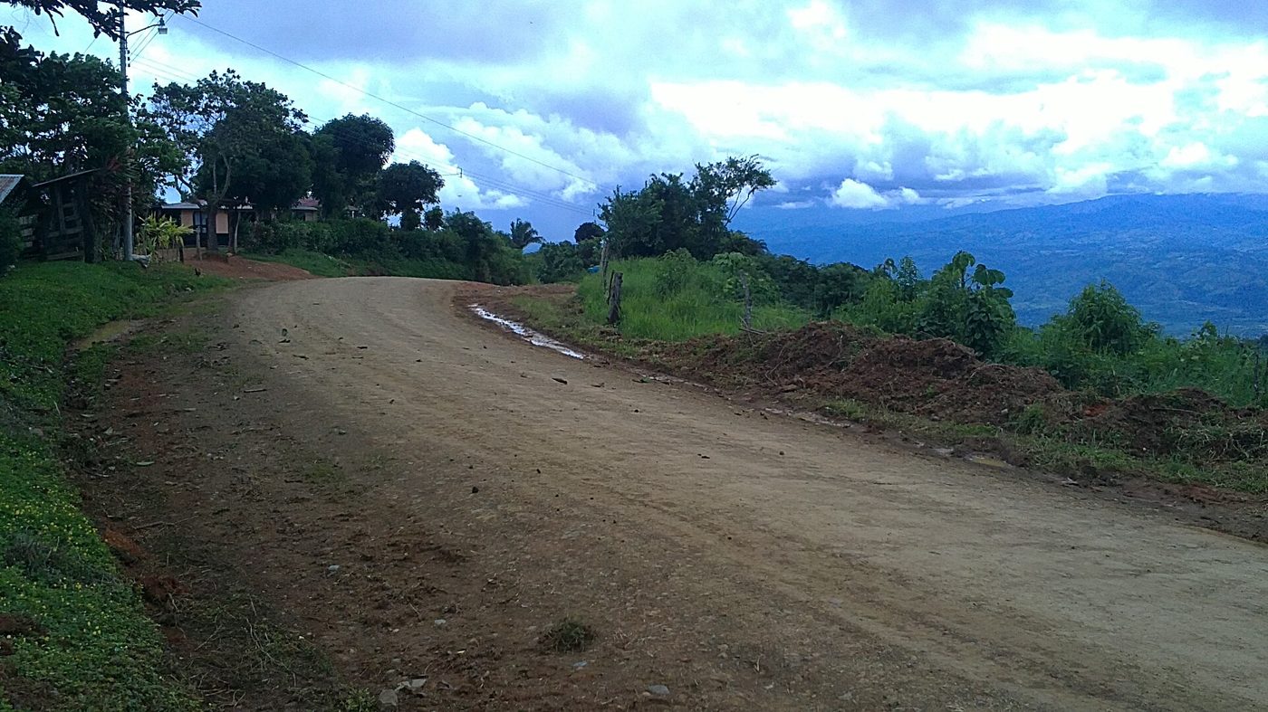
The roads of Costa Rica are a mix. The main highways are paved and generally in fair shape, while thousands of kilometers of secondary roads are gravel or dirt. In the rainy season, some back roads turn to mud or get cut off entirely. With Waze, common sense, and the right vehicle, driving here is very manageable.
The night a shortcut went very wrong
Long before we settled in Playas del Coco, we were renting a house in Uvita, on the southern Pacific coast, and thinking about making it home. One afternoon we drove over the mountains to San Isidro de El General, the nearest real city. The road out was beautifully paved, with views the whole way down to town. We explored, stocked up at Walmart, and got a little too confident.
For the drive back, Google Maps offered a second route. New scenery, we thought. Before long we were on a muddy dirt track that our small car had no business being on. The tires lost grip, the car slid, and Steve steered us into the side of the mountain, which sounds bad until you consider the drop waiting on the other side.
The car was stuck, there was no cell signal, and daylight was fading, so we started walking down. Between us we had exactly one pair of shoes suited to a slick mountain track, and the rubber Birkenstocks lost: a fall on the way down fractured a toe. Once we picked up a signal, Steve called 911 and gave the dispatcher our GPS coordinates. A few miles later we met a German father and his young daughter, stranded exactly like us, and shared our phone so they could reach their family.
The rescue arrived just before sunset: a Toyota Land Cruiser ambulance built for exactly this kind of road. Everyone squeezed in, mud and all, and on the way down it forded a river our little car could never have crossed. At the bottom, the police drove the German family onward while the paramedics took us to the hospital. One broken toe, one very stuck rental car, and one lesson we have repeated to every visitor since.
Are the roads in Costa Rica really that bad?
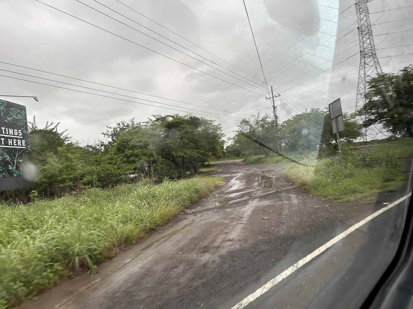
Honestly, no, but they demand respect. The main corridors are paved and mostly fine, including the routes that matter for Guanacaste: the Inter-American Highway and the roads linking Liberia with the beach towns. Plenty of secondary roads, though, are gravel or dirt, and even paved stretches can surprise you. The U.S. State Department's Costa Rica page puts it plainly: unclear lane markings, narrow shoulders, large potholes, and some places that are only reachable with a four wheel drive vehicle.
What trips up new arrivals is how fast conditions change. You can leave a smooth two lane highway, turn at a sign pointing to a beach, and be on rutted gravel within a minute. That is normal here, not a wrong turn. The skill is knowing which roads to take slowly, and which ones not to take at all in the wrong season.
What changes in the rainy season?
Costa Rica's rainy season runs from May to October, with November as a transition month, according to the Costa Rica Tourism Board. Here in Guanacaste the early months are gentle: sunny mornings, an afternoon downpour, green hills everywhere. The tail end of the season is another story. Dirt roads that were dusty washboard in February become soft, slick mud in October. Dry stream beds grow into real crossings. Landslides can close mountain routes without warning.
Two rules cover most of it. First, never drive into water if you cannot judge its depth; if a crossing looks doubtful, it is. Second, if a route includes an unpaved mountain stretch in the rainy months, take the longer paved way instead. The long way around is nearly always faster than a tow truck.
Waze or Google Maps: which one should you use?
Use Waze. It is the app most drivers in Costa Rica run, which matters because its data comes from those same drivers. Closures, crashes, and flooded stretches show up quickly, reported by people who just drove past them. Our Uvita adventure started with Google Maps offering a second route that no local would ever have suggested. Mapping apps have improved since that day in 2023, but we still see rough tracks presented as reasonable alternatives.
Whichever app you choose, run its suggestions through a filter of common sense. If a route saves ten minutes by leaving the highway for an unnamed road, decline politely. Ask at your hotel, or ask us. People here give directions gladly, usually anchored to landmarks rather than street names, because most streets never had usable names to begin with.
Do you need a 4x4 in Costa Rica?
It depends on where you are going and when. If you are staying in a developed beach town like Coco and driving paved routes in the dry season, a normal car is fine. If you plan to explore waterfalls, look at rural property, or drive anything unpaved between May and November, rent a true 4x4 with real ground clearance, not a city crossover wearing all wheel drive badges.
A few practical notes. Visitors can drive on a valid home country license for up to three months, per the tourism board, so carry it along with your passport. The nationwide emergency number is 911, and it worked for us in the middle of nowhere once we found signal. And try not to drive rural roads after dark: they are unlit, and potholes, pedestrians, cyclists, and the occasional cow appear out of nowhere. Our post on driving in Costa Rica covers rules and rental tips in more detail.
What are the roads like around Playas del Coco?
This is one of the reasons we ended up on this coast. Playas del Coco is among the easiest beach towns in the country to reach: the drive from Liberia's international airport is paved the entire way and takes about half an hour. The main road through town is paved, the road over the hill to Ocotal is paved, and most daily errands never touch gravel. Some hillside communities have steep sections, but they are short and maintained.
That accessibility shapes everything from rental demand to resale value, and it is a real difference between Coco and towns that sit at the end of long gravel roads. If you are comparing destinations, read what makes Playas del Coco different, and our guide to the best time to visit Costa Rica explains the seasons in more depth.
Planning a scouting trip? We will gladly mark up your route, tell you which stretches actually need the 4x4, and show you around once you arrive. Browse our current listings, learn more about life in Playas del Coco, or send us a message and ask anything, including what shoes to pack. Not rubber sandals.
Frequently asked questions
Do I need a 4x4 to drive in Costa Rica?
Not always. For paved routes between major towns in the dry season, a standard car works. For the rainy season (May to October), rural property tours, or any route with unpaved stretches, choose a true 4x4 with high clearance. The U.S. State Department notes some areas are only reachable with four wheel drive.
Should I use Waze or Google Maps in Costa Rica?
Most drivers in Costa Rica use Waze, and we recommend it. Its live reports on closures, floods, and accidents come from local drivers, and it is less likely to route you onto rough mountain tracks. Whatever app you use, be skeptical of shortcuts that leave the main highway, especially in the rainy season.
Is it safe to drive in Costa Rica at night?
We avoid rural driving after dark and suggest visitors do the same. Roads are unlit, shoulders are narrow, and potholes, pedestrians, cyclists, and animals appear suddenly. The U.S. State Department gives similar advice. Short drives in town are routine. Plan longer trips to end before sunset, which comes close to 6 pm year round.
Cover photo: Jorge Arturo Villalo… (Panoramio), CC BY-SA 3.0, via Wikimedia Commons · Photo: Cuban Boy, CC0, via Wikimedia Commons